Offline Geological Workflow

Raw drillhole data to resource estimates,
on your laptop.

Validate drillhole data, run EDA, and build resource estimates — all in one offline tool. Your data stays with you.

Free · no credit card Works offline Pros & academics Bilingual · EN / ID
Request Trial →
⚡ The Killer Feature

The only offline tool that produces auditor-ready KCMI/JORC reports in ~5 minutes — from raw collar to resource statement.

No cloud. No subscription. No data leaves your laptop. Just drag a CSV, run the workflow, and export a KCMI-aligned report that a Competent Person can sign off.

~5
MIN: RAW → REPORT
3,000+
DRILLHOLES PROCESSED
100%
OFFLINE
collar.csv717 holes loaded
survey.csv667 surveys
assay.csv10,018 samples
Validate → 0 errors
EDA → Au CV 6.49 → top-cut
Variogram → spherical model
Kriging → 171,600 blocks
KCMI_Report.pdf
⏱ 4m 32s · offline
3,000+
drillholes processed
~5 min
from raw to clean
100%
offline — data never leaves
KCMI & JORC
aligned reports
Features in action

Every feature, explained

Tangkapan layar asli dari setiap fitur. Klik untuk perbesar. Data produksi Thalanga VMS, bukan mockup.

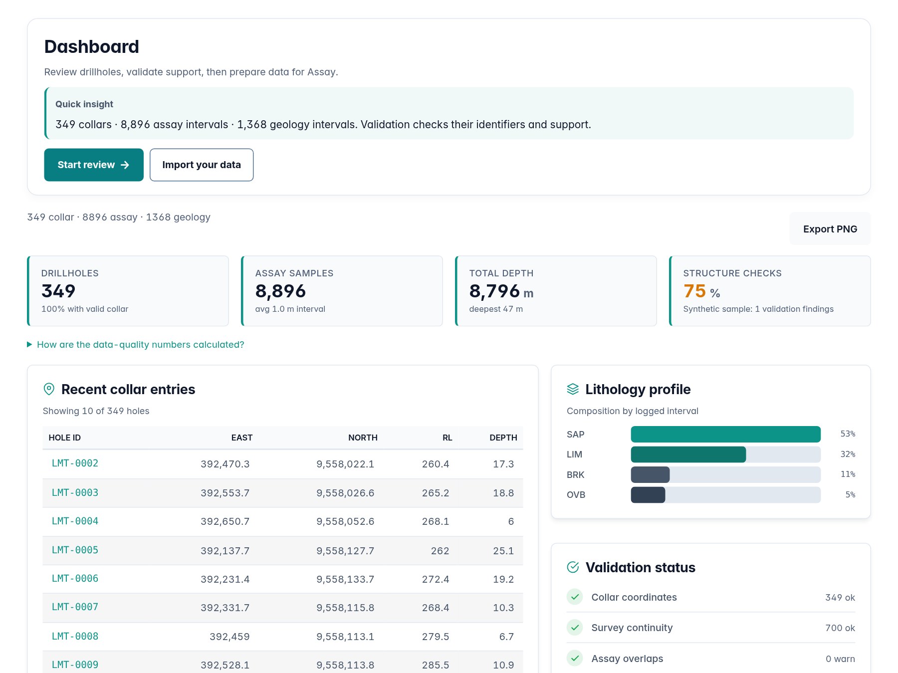
Project Dashboard — 717 drillholes, validation status
⚡ Core

Project Dashboard

Ringkasan 717 drillholes, 10,018 assays — status validasi, tipe data, metadata proyek.

Import — 4 CSV auto-classify
Core

Drag & Drop Import

Upload 4 CSV sekaligus — auto-classify Collar, Survey, Assay, Geology. Deteksi delimiter otomatis.

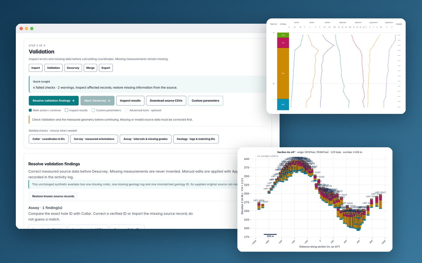
Cross-Table Validation — orphan, gap, BDL, duplicate flagging
Core

Cross-Table Validation

Auto-flag orphan assays, missing surveys, BDL intervals, duplicate samples, outlier statistik.

Strip Log — multi-track viewer lithology + grade curves
Core

Strip Log Multi-Track

Visualisasi downhole: lithology, weathering, assay curves multi-element (Au, Ag, Cu, Pb, Zn).

Cross Section — multi-hole 2D correlation
Core

Cross Section 2D

Multi-hole correlation section dengan trace drillhole, lithologi, dan grade projection.

Desurvey — 3D minimum curvature trace
Core

Desurvey 3D

Minimum Curvature algorithm — compute 3D downhole trace dari survey data. Output X/Y/Z untuk block model.

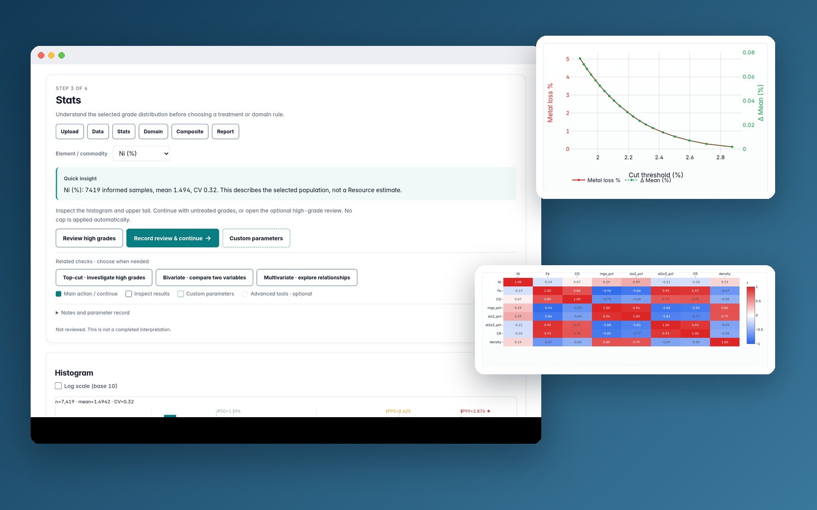
Assay EDA — histogram, boxplot, statistics
Assay

EDA & Statistics

Histogram, boxplot, descriptive stats per element — mean, median, CV, skewness, kurtosis.

Correlation matrix — Pearson heatmap multi-element
Assay

Multi-Element Correlation

Heatmap Pearson + Spearman correlation. Temukan asosiasi element (Au-Cu, Pb-Zn-Ag) untuk domaining.

Bivariate scatter matrix
Assay

Bivariate Scatter Matrix

Scatter plot pairwise inter-element. Identifikasi hubungan linear/non-linear dan outliers.

Multivariate analysis — PCA clustering
Assay

Multivariate Analysis

PCA, biplot, dan clustering. Reduksi dimensi multi-element untuk pola geokimia tersembunyi.

Top-cut analysis — capping high-grade outliers
Assay

Top-Cut Analysis

Identifikasi & capping high-grade outliers. Histogram + CDF sebelum/sesudah top-cut untuk distribusi normal.

Lithology analysis — domain statistics per rock type
Assay

Lithology Domaining

Statistik per lithology/domain. Bedah distribusi grade per tipe batuan untuk domaining yang akurat.

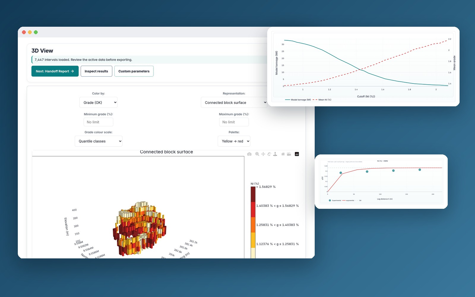
Variography — experimental + model variogram
Resource

Variography

Experimental variogram + spherical/exponential/gaussian model fit. Anisotropy analysis per domain.

3D Block Model — kriging estimation 171K blocks
Resource

3D Block Model

Interactive 3D block model — Ordinary Kriging, IDW. 171,600 blocks, color-coded by grade.

Resource Classification — Measured/Indicated/Inferred
Resource

KCMI Classification

Auto-classify Measured/Indicated/Inferred berdasarkan kriging efficiency, slope of regression, drill spacing.

Grade Tonnage Curve — cutoff analysis
Resource

Grade-Tonnage Curve

Kurva tonase kumulatif & grade rata-rata vs cutoff grade. Siap untuk resource statement KCMI Table 1.

Estimation results — kriging output per block
Resource

Estimation Results

Ordinary Kriging & IDW estimation per block. Tabular output: block ID, X/Y/Z, grade, variance, search radius.

3D visualization — interactive block model rotation
Resource

3D Visualization

Interactive 3D block model viewer. Rotate, zoom, pan. Color-coded by grade — visual QA untuk estimation.

Mulai dari Core — gratis, tanpa install. Data sample langsung bisa dicoba.

Try Core Web — free →

Atau request trial untuk full bundle →

Why GeoSuite

Built around how geologists actually work

Workflows from real exploration projects. Aligned with SNI 4726:2019, KCMI 2017, and JORC 2012.

Your data stays with you

No uploads. No cloud. No telemetry. Drag a CSV, get insights. Works fully offline.

First chart in 5 minutes

No install. No setup. No environment to configure. Open and start working.

Output aligned with KCMI & JORC

Reporting templates built around KCMI 2017 and JORC 2012. Output tables and PDF metadata match what Competent Persons and auditors review.

What you get

Three modules. One complete workflow.

From drillhole validation to resource estimation. Each module is a standalone tool — together they're a full pipeline.

Free Core dashboard — 717 drillholes, validation status

GeoSuite Core

Validate & clean collar, survey, assay, geology data. Strip logs, cross-sections, desurvey.

12 tabs · raw to clean in ~5 min

In bundle Assay EDA — histogram, boxplot, correlation matrix

GeoSuite Assay

EDA komplit sesuai standar profesional. Bivariate, multivariate, spacing, top-cut, domain.

12 tabs · spacing → domain → composite

In bundle
In bundle Resource 3D block model — kriging estimation, classification

GeoSuite Resource

Resource statement dalam hitungan menit. Variography, kriging, block model, classification.

12 tabs · variogram → kriging → report

In bundle
Social proof

Trusted by geologists & academics

Used in real exploration projects and academic resource estimation coursework.

Academic Research
KCMI 2017
JORC 2012
SNI 4726:2019
Offline-First
FAQ

Common questions, straight answers

Does this replace commercial 3D mining software?
No. Orebit covers the workflow that comes before — fast and offline. Use it for validation, EDA, and resource estimation prep. For production 3D modelling, pair it with your existing software.
Can I use the output for KCMI or JORC reports?
Yes. Output tables and PDF metadata match KCMI 2017 and JORC 2012 reporting templates. The KCMI Table 1 export is structured for Competent Person sign-off.
Is my drillhole data safe?
100%. GeoSuite runs locally on your machine — as a desktop EXE or directly in the browser. No uploads, no cloud, no telemetry. Your data never leaves your machine.
What file formats does it accept?
Standard CSV (comma-separated). Export to CSV, DXF (3D solids), PNG/SVG (plots), and PDF (KCMI report). Compatible with all major mining software.
What if I find a bug or have a question?
Email support@orebit.id or message directly via the in-app chat. Bugs are fixed within 48 hours. You speak directly with the developer — no ticket queue.
How is the price this low?
No server costs (offline-first), no subscription infrastructure, no sales team. The savings pass to you. One-time payment, perpetual license.
Can I use this completely offline?
Yes. The desktop EXE works with zero internet connection. The web version loads once, then works offline (PWA). No data sync, no cloud dependency.

Ready to model your drillhole data?

Start free with GeoSuite Core. Upgrade when you need the full workflow.

Request Trial →